
(10:30AM – Thursday, May 23rd, 2024) Thursday morning update regarding a storm system will move through the region on Friday, bringing at least one round of rain and t’storms to the state from Friday morning through Friday night, with the likelihood for severe t’storms with some of the activity.
Update…
•With this update, we have increased severe t’storm probabilities across the entire state on the severe t’storm forecast for Friday/Friday night. This change was made based on increasing confidence in the expected outcome and the latest trends in weather model guidance.
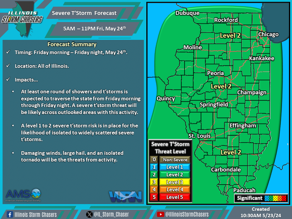
Timing…
•Friday Morning – Friday Night, May 24th.
Location…
•All of Illinois.
Impacts…
•A level 1 to 2 severe t’storm risk is in place across all of Illinois from Friday morning through Friday night for the likelihood of isolated to widely scattered severe t’storms. Damaging winds, large hail, and an isolated tornado will be the threats from activity. At least one round of showers and t’storms is expected to traverse the state from Friday morning through Friday night. A severe t’storm threat will be likely across outlooked areas with this activity.
