
(11:45AM – Friday, April 17th, 2026) Potentially widespread and significant severe t’storm threat expected thru late tonight/early Saturday…
⚠️Update…
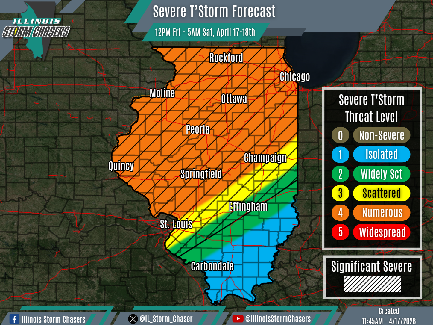
•With this update cycle, on the forecast for today/tonight, we have expanded severe t’storm probabilities across the state and have increased severe t’storm probabilities to a level 4 risk across a good chunk of the state. These changes were to account for increasing chances of increased coverage of severe t’storm potential, and increased confidence that this scenario will occur.
⏰📍Timing & Location…
•This Afternoon – Early Saturday Morning, April 17-18th: All of Illinois.
⚡️Hazards…
•A level 1 to 4 severe t’storm threat is in place across state-wide from this afternoon through early Saturday morning, for the threat of isolated to numerous severe t’storms. All modes of severe weather will be likely, including large hail, damaging winds and a few/several tornadoes. Some significant severe t’storms will be likely across Northern and Central Illinois as well, capable of producing very large hail (2.00″+), significant damaging winds (75MPH+), swaths/corridors of damaging winds and/or a strong tornadoes.
✔️Summary…
•This Afternoon – Early Saturday Morning… Scattered showers and t’storms will develop in the vicinity of a pre-frontal boundary across portions of Eastern Iowa, Northwestern Illinois and Southwestern Wisconsin this afternoon. This activity will have the best chance of featuring discrete supercells early on, capable of all modes of severe weather, including large hail (very large possible) and tornadoes (some strong). This activity will track E/NE, affecting portions of Northern Illinois from initiation this afternoon through this evening. Additionally, more widespread showers and t’storms will develop this afternoon across portions of Minnesota, Southwestern Wisconsin, Iowa and Missouri. While activity may begin more discrete/cellular in nature, this activity will likely quickly grow upscale into a broken line of activity (QLCS), as it sweeps across the state this evening through early Saturday morning. While all modes of severe weather will be possible with this activity as well, damaging winds will tend to become the greatest threat, potentially becoming widespread and significant.
