
(10:30AM – Wednesday, April 1st, 2026) Severe t’storm threat continues for today and tomorrow…
⚠️Update…
•With this update, we have slightly expanded severe t’storm probabilities on the forecast for today/tonight, based on the latest data and trends.
•With this update, we have increased severe t’storm probabilities to a level 2 across portions of the state on the forecast for Thursday/Thursday night, to account for the potential of slightly higher coverage severe t’storm potential.
⏰📍Timing & Location…
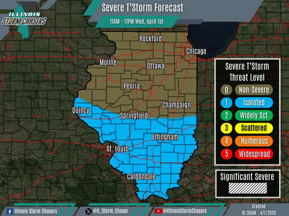
•This Morning – Tonight, April 1st: Southern Illinois.
•Thursday Morning – Thursday Night, April 2nd: All of Illinois.
⚡️Hazards…
•A level 1 severe t’storm threat is in place across Southern and Western Illinois from this morning through tonight, for the threat of isolated severe t’storms. Hail, damaging winds and an isolated tornado will all be threats.
•A level 1 to 2 severe t’storm threat is in place across all of Illinois from Thursday morning through Thursday night, for the threat of isolated to widely scattered severe t’storms. Damaging winds, hail and isolated tornadoes will all be threats.
✔️Summary…
•This Morning – Tonight… A cold front pushing through Southern Illinois on today will become stationary for a time, before lifting north as a warm front tonight. Widespread areas of rain and t’storm activity are expected across the state from this Wednesday morning through tonight. Of focus will be in the vicinity of the aforementioned frontal boundary in Southern Illinois, where a low coverage severe t’storm threat may exist.
•Thursday Morning – Thursday Night… As the next storm system passes through the region, a round or two of rain and t’storm activity will be likely across the state from Thursday morning and Thursday night. The first round of activity, likely to move across the state from Thursday morning through early Thursday evening, will pose some severe t’storm threat. Pending exact progression of this round of activity and potential for recovery in it’s wake, a second round of rain and t’storm activity may be possible across Northern and Central Illinois from later Thursday afternoon into Thursday night. This second round is more is question at this time, but should it come to fruition, it would carry some severe t’strom threat as well.

