
(10:30PM – Sunday, April 12th, 2026) Multi-day severe weather event expected early/mid week…
⏰📍Timing & Location…
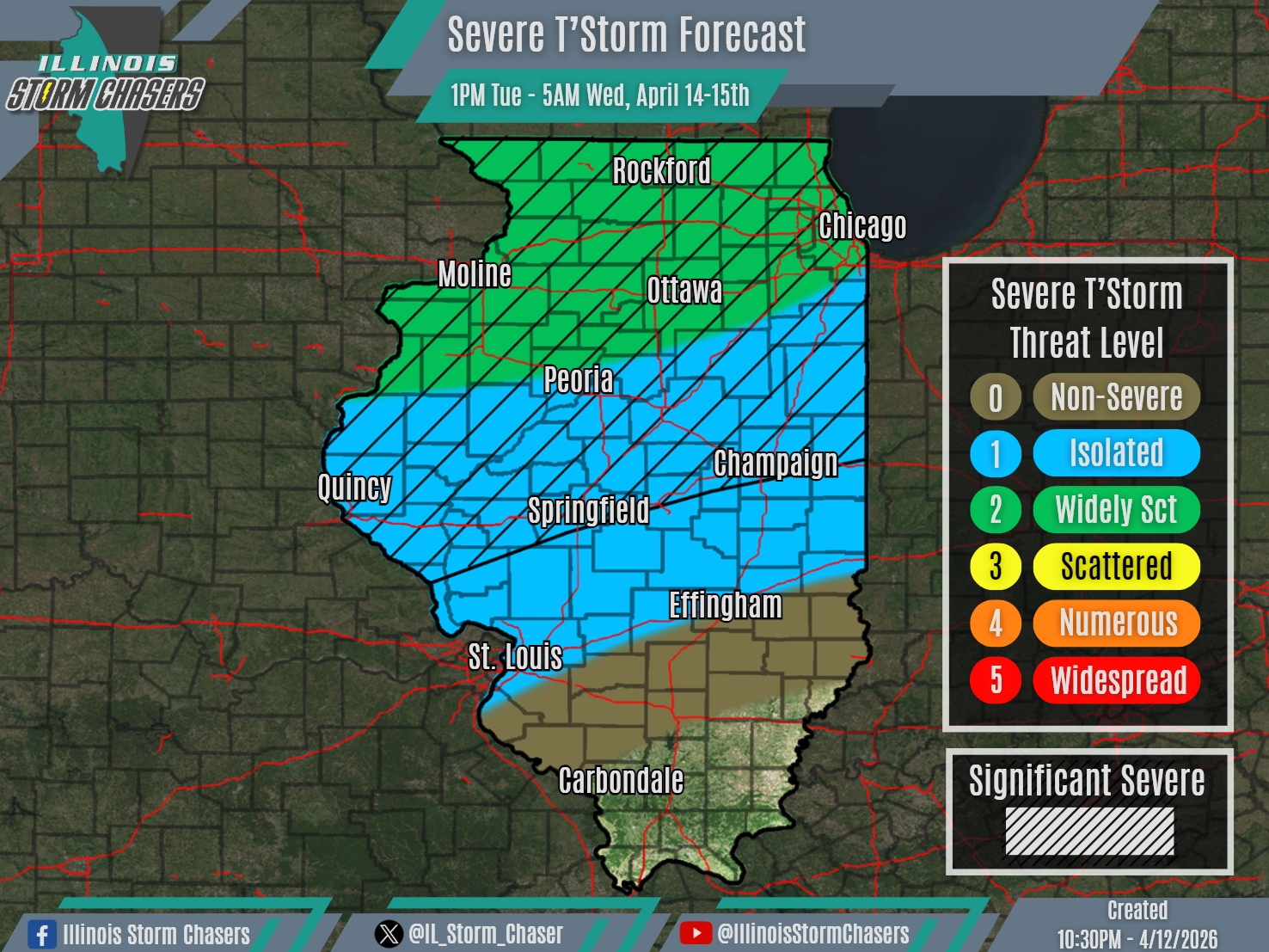
•Tuesday Afternoon – Early Wednesday Morning, April 14-15th: Northern & Central Illinois.
•Wednesday Morning – Early Thursday Morning, April 15-16th: Much of Illinois.
⚡️Hazards…
•A level 1 to 2 severe t’storm threat is in place across Northern and Central Illinois from Tuesday afternoon through early Wednesday morning, for the threat of isolated to widely scattered severe t’storms. All modes of severe weather will be possible, including large hail, damaging winds and a few tornadoes. Some significant severe t’storms will be possible across Northern and Central Illinois, capable of producing very large hail (2.00″+) and a strong tornado.
✔️Summary…
•Tuesday Afternoon – Early Wednesday Morning… Scattered showers and t’storm are expected to develop on Tuesday afternoon ahead of frontal boundary, across portions of Southern Wisconsin, Eastern Iowa and Northern Illinois. This activity will then traverse Northern Illinois through Tuesday night/early Wednesday morning. Some of this activity may also make it into portions of Central Illinois by late Tuesday night/early Wednesday morning as well. Otherwise, shower and t’storm activity that develops across Missouri on Tuesday afternoon may also move into portions of Central Illinois Tuesday night/early Wednesday morning.
•Wednesday Morning – Early Thursday Morning… A severe t’storm threat will also exist on Wednesday into very early Thursday. A forecast for this timeframe will be released during a future forecast cycle.
