
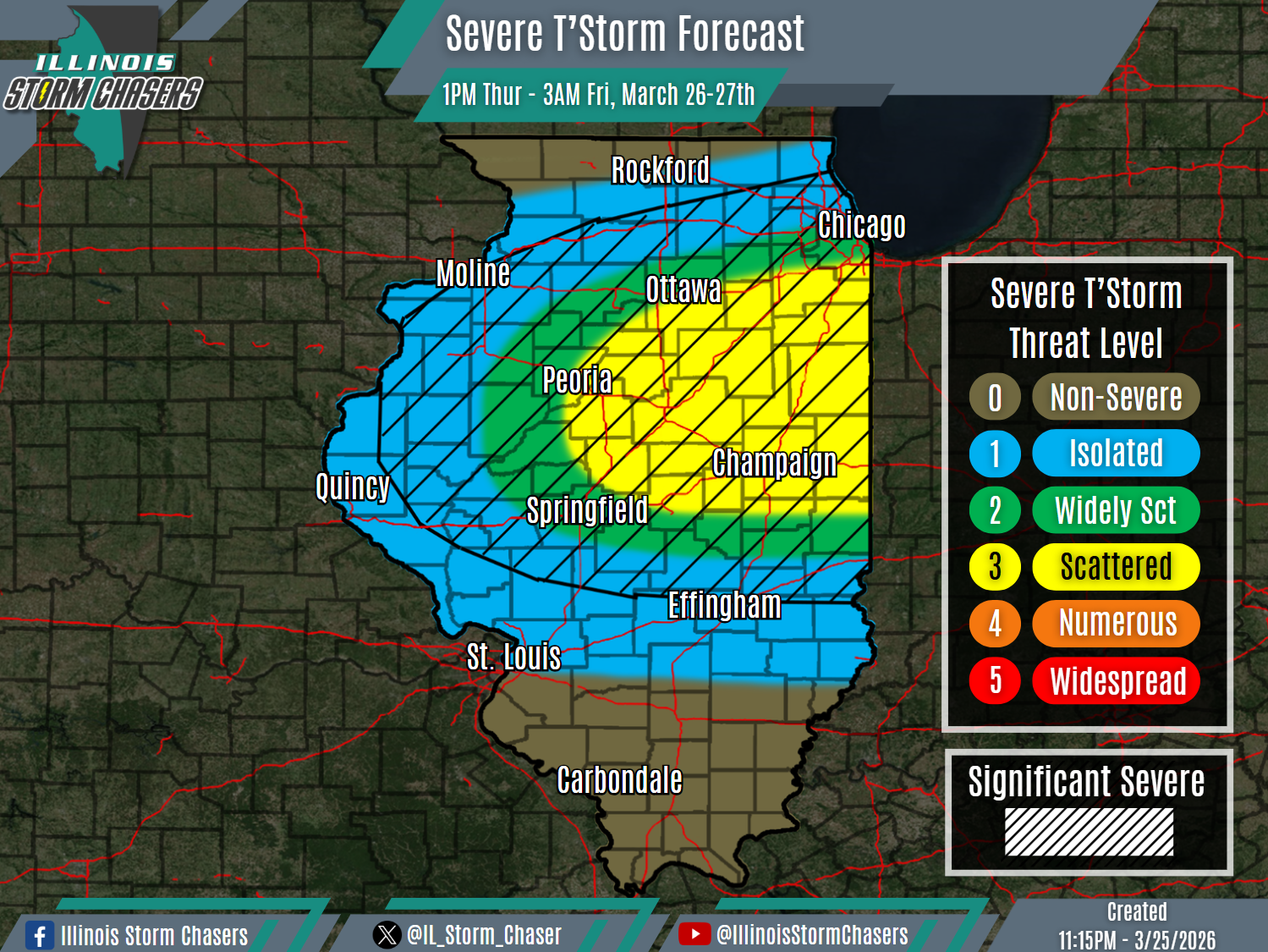
(11:15PM – Wednesday, March 25th, 2026) Severe t’storm continues to be likely for Thursday… #ILWx
⚠️Update…
•With this update, we have slightly adjusted the placement of severe t’storm probabilities based on the latest data and trends. Otherwise, no significant changes were needed with this forecast cycle.
⏰Timing…
•Thursday Afternoon – Early Friday Morning, March 26-27th.
📍Location…
•Much of Illinois.
⚡️Hazards…
•A level 1 to 3 severe t’storm threat is in place across much of the state from Thursday afternoon through early Friday morning, for the threat of isolated to scattered severe t’storms. Large hail will be the main threat, but an occurrence of damaging winds or an isolated tornado cannot be ruled out. Some significant severe t’storms will be possible, capable of producing very large hail (2.00″+).
✔️Summary…
•As a storm system moves through the region, a cold front will sweep southward across the state between Thursday afternoon and Friday morning. Scattered showers and t’storm will develop along/ahead of this cold front on Thursday afternoon across portions of Northern Illinois, with activity expected to track east/southeast across portions of Northern and Central Illinois from Thursday afternoon into Thursday night, and into Southern Illinois into later Thursday night and early Friday morning. Severe t’storms will be possible with this activity.
