
(11:45AM – Sunday, March 15th, 2026) Winter storm set to bring near accumulating snow to portions of the state from this evening through Monday…
⚠️Update…
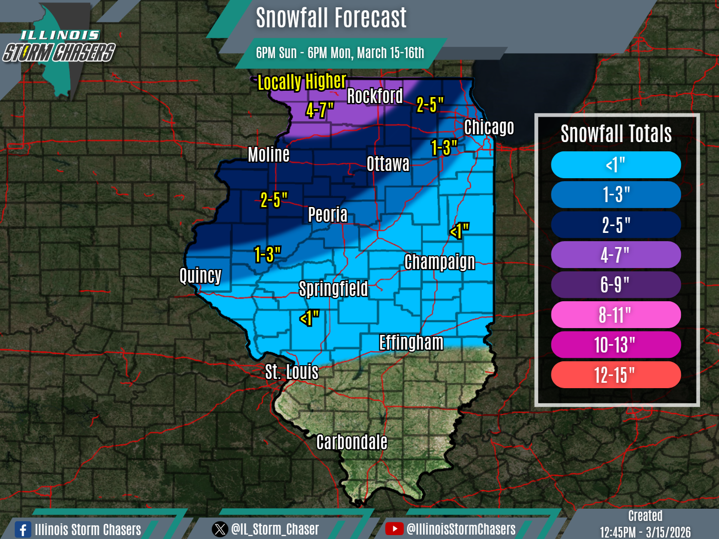
•With this forecast cycle, we have slightly expanded snowfall accumulation ranges across the northern half state. This change was made based on consistent trends within weather guidance. Additionally, we have increased snowfall totals across portions of far Northern Illinois.
⏰Timing…
•Sunday Evening – Monday Afternoon, March 15-16th.
📍Location…
•Northern & Central Illinois.
❄️Hazards…
•Snowfall accumulation will range from a dusting to 4-7″ across Northern and Central Illinois, with the highest totals of 4-7″expected to be across Northern Illinois, where locally higher amounts will be possible as well.
•High winds gusts of 40-60MPH will result in blowing and drifting snow, especially in open/rural areas. Near blizzard to blizzard conditions will be possible, especially across Western and portions of Northern Illinois.
•Travel will be impacted across affected areas.
✔️Summary…
•A significant winter storm moving through the region, which is also bringing severe t’storms and high wind to the state, will also bring the likelihood of accumulating snow to portions of the state as well.
•In the wake of a cold frontal passage and as the storm systems’ low pressure passes overhead and to the east, colder air will filter in this evening into tonight. An area of snow will move in and further develop as it does so, traversing Northern and Central Illinois from this evening through Monday afternoon.
•In addition to the snow, high winds of 40-60MPH will also be likely. The Combination of snow and wind will lead to near blizzard to blizzard conditions, especially across Western and portions of Northern Illinois.
