
(11:45PM – Saturday, March 14th, 2026) Accumulating snow possible across portions of the state Sunday/Monday…
⚠️Update…
•With this forecast cycle, we have slightly expanded snowfall accumulation ranges across the state. This change was made based on consistent trends within weather guidance.
⏰Timing…
•Sunday Evening – Monday Afternoon, March 15-16th.
📍Location…
•Northern & Central Illinois.
❄️Hazards…
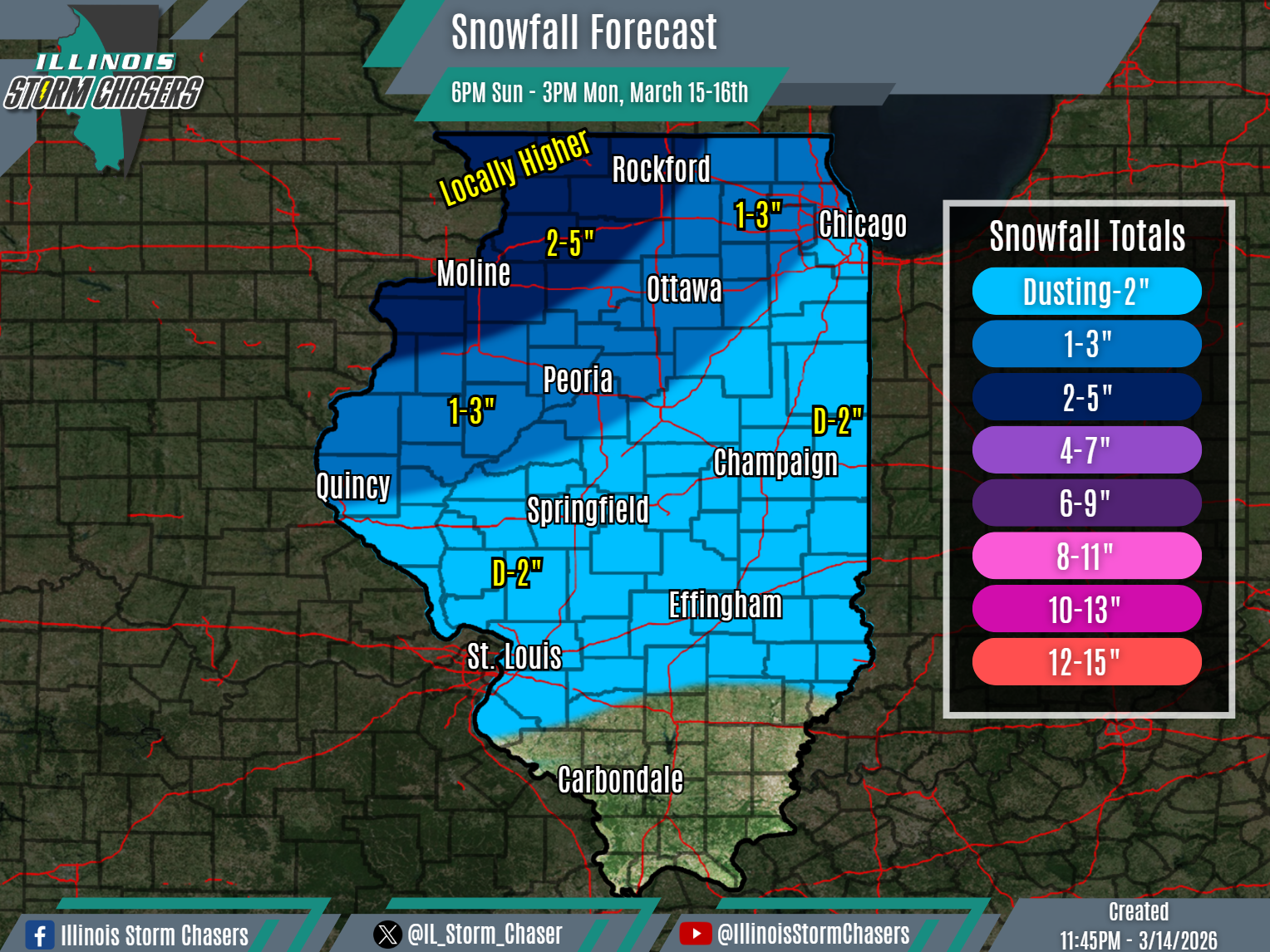
•Widespread light snowfall accumulation of a dusting to 2-5″ will be possible across Northern and Central Illinois, with locally higher amounts possible across far Northwestern Illinois.
•High winds gusts of 40-55MPH will result in blowing and drifting snow, especially in open/rural areas. Near blizzard to blizzard conditions will be possible, especially across Northwestern Illinois.
•Travel will be impacted across affected areas.
✔️Summary…
•A significant winter storm will move through the region to end the weekend and begin this upcoming week, bringing multiple forms of weather to the state and region. This will include a widespread light accumulating snowfall, which will affect North and Central Illinois between Sunday evening and Monday afternoon.
•In the wake of a cold frontal passage and as the storm systems’ low pressure passes overhead and to the east, colder air will filter in Sunday evening into Sunday night. An axis of snow will move in and further develop as it does so, traversing Northern and Central Illinois from Sunday evening through Monday afternoon.
•In addition to the snow, high winds of 40-55MPH will also be likely. The Combination of snow and wind will lead to near blizzard to blizzard conditions, especially for Northwestern Illinois. So, while snowfall accumulation totals are not currently expected to be high, overall conditions may prove to be impressive.
