
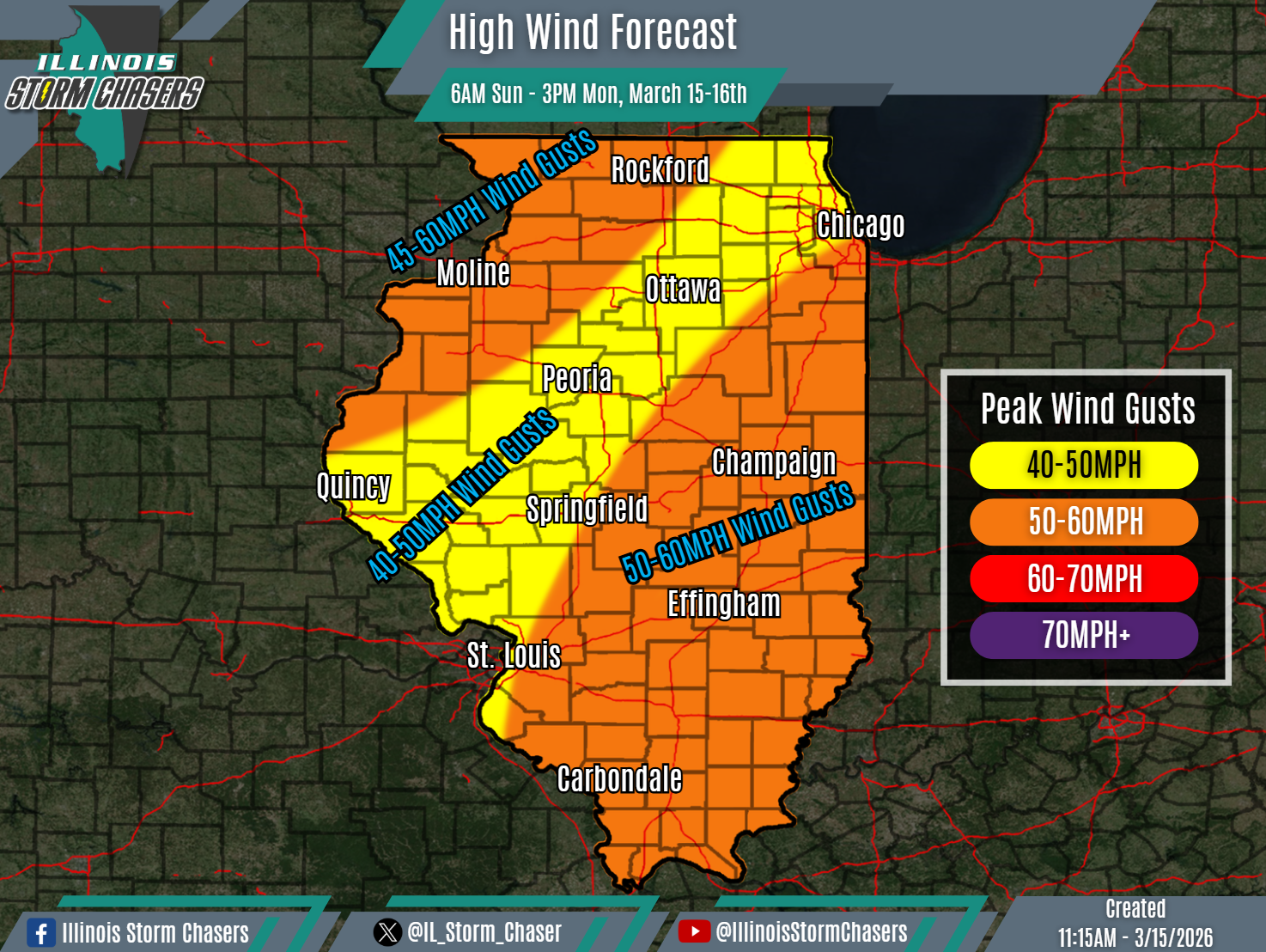
(11:15AM – Sunday, March 15th, 2026) High winds expected across the state thru Monday afternoon…
⚠️Update…
•With this forecast cycle, little to no changes were needed, as the going forecast is on track.
⏰Timing…
•Sunday Morning – Monday Afternoon, March 15-16th.
📍Location…
•All of Illinois.
💨Hazard…
•Peak high wind gusts of 40-60MPH will be likely across the state in two overlapping waves between this morning and Monday afternoon.
•Winds will be southerly from this morning into this afternoon, shifting westerly from this afternoon into this evening, then shifting northwesterly from early tonight night into Monday afternoon.
•The high winds will have the potential to blow around light-weight/loose items, cause tree damage and cause power outages.
✔️Summary…
•As a potent storm system develops and moves through the region, two overlapping waves of high winds will impact the state from this morning through Monday afternoon.
•The first wave of high winds will be the product of a strong southerly low-level jet and adequate mixing, which will bring high winds to much of the state with wind gusts over 40MPH, from this morning through this evening. However, a corridor of enhanced wind gusts of 50-60MPH wind gusts will be likely over the eastern chunk of the state.
•The second wave of high winds will be the product of a strong northwesterly low-level jet, a rapidly deepening low pressure, strong cold air advection and adequate mixing. The combination of these factors will bring high winds to much of the state with wind gusts over 40MPH, from this evening through Monday afternoon. However, a corridor of enhanced wind gusts of 45-60MPH wind gusts will be possible across northwestern portions of the state.
