
(11:00PM – Sunday, December 27th, 2025) A potent storm system will continue to bring impacts to the state into Monday, in the form of high winds and accumulating snow…
❗Update…
•The severe t’storm threat has ended across affected the state as of tonight.
•With this update, we have slightly adjusted expected snowfall accumulation for some areas across Northern and Central Illinois, based on the latest guidance and observational trends.
⏰Timing…
•High Winds: Thru Monday Midday, December 29th.
•Snow: Thru Monday Morning, December 29th.
📍Location…
•High Winds: All of Illinois.
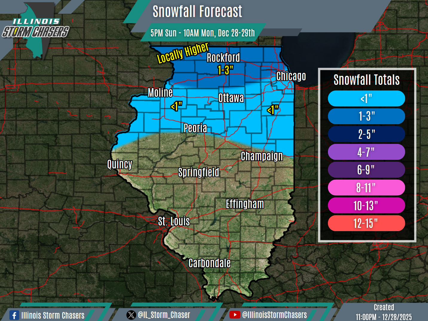
•Snow: Northern & Central Illinois.
💨❄️Hazards…
•Peak high wind gusts of 30-50MPH will continue to be likely across the state through Monday midday. Isolated higher wind gusts will be possible across the northern half of the state. Winds will be westerly to northwesterly. The high winds will have the potential to blow around light-weight/loose items and may cause isolated tree damage.
•Snowfall accumulation of a dusting to as much as 1-3″ will be likely across the northern half of Illinois through Monday morning. Locally higher snowfall totals may be possible across far Northwestern Illinois.
✔️Summary…
•As a potent storm system moves through the region, impactful weather will continue across the state into Monday.
•Strong cold air advection is occurring across the state on the backside of the storm system, in the wake of the cold frontal passage today. With a strong low-level jet and adequate atmospheric mixing, a period of high synoptic winds will continue across the state through Monday midday.
•As much colder air quickly moves in on the backside of the storm system and precipitation wraps around, snow/snow showers will traverse the northern half of the state through Monday morning, with minor snowfall accumulations likely.

