
(11:30AM – Sunday, December 27th, 2025) A potent storm system bringing significant impacts to the state to end the weekend/begin the week…
❗Update…
•With this update, we have increased severe t’storm probabilities across a large chunk of the state. Confidence in higher coverage severe t’storm potential has increased.
•With this update, we have increased expected snowfall totals across the northern half of the state, as weather guidance is in agreement in the accumulating snowfall potential.
⏰Timing…
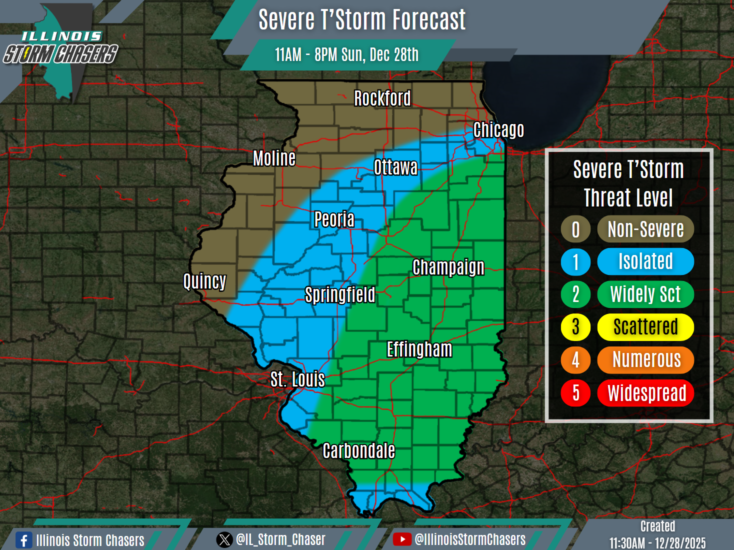
•Severe T’Storm Threat: This Morning – Sunday Evening, December 28th.
•High Winds: Midday Today – Monday Afternoon, December 28-29th.
•Snow: This Evening – Monday Morning, December 28-29th.
📍Location…
•Severe T’Storm Threat: Much of Illinois.
•High Winds: All of Illinois.
•Snow: Northern & Central Illinois.
⚡️💨❄️Hazards…
•A level 1 severe t’storm threat is in place across much of Illinois from this morning through Sunday evening, for the threat of isolated severe t’storms. Damaging winds, hail and a few tornadoes will be the main threats with activity.
•Peak high wind gusts of 35-50MPH will be likely across the state from midday today through Monday afternoon. Isolated higher wind gusts will be possible across the northern half of the state. Winds will be westerly to northwesterly. The high winds will have the potential to blow around light-weight/loose items and may cause isolated tree damage.
•Snowfall accumulation of a dusting to as much as 1-3″ will be likely across the northern half of Illinois from this evening through Monday morning.
✔️Summary…
•As a potent storm system moves through the region, impactful weather is likely across the state today and Monday.
•Widespread rain and t’storm activity will traverse the state today, as a warm front lifts northward across the state and then a cold front quickly sweeps eastward across the state. An initial round of rain/t’storm activity traversed Northern and Central Illinois this morning, with some severe t’storm activity having occurred as well. A second round of activity will develop and sweep across much of Central and Southern Illinois from this afternoon through this evening, posing a severe t’storm threat.
•Strong cold air advection will occur across the state in the wake of the cold frontal passage, on the backside of the storm system. With a strong low-level jet and adequate atmospheric mixing, a period of high synoptic winds will be likely across the state from midday today through Monday afternoon.
•As much colder air quickly moves in on the backside of the storm system and precipitation wraps around, snow/snow showers will traverse the northern half of the state from this evening through Monday morning.


