
(10:45AM – Sunday, March 15th, 2026) Severe t’storm threat thru early tonight…
⚠️Update…
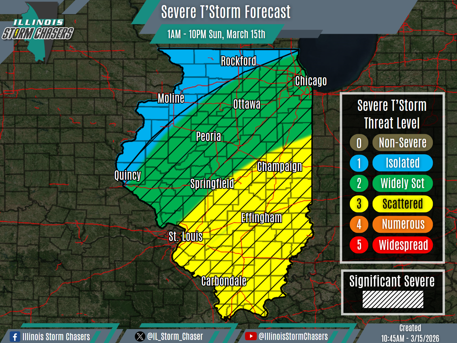
•With this forecast cycle, minor threat placement changes were made, based on real-time observations and trends within weather guidance.
⏰Timing…
•Sunday Morning – Sunday Night, March 15th.
📍Location…
•Much of Illinois.
⚡️Hazards…
•A level 1 to 3 severe t’storm threat is in place across much of the state from this morning through Sunday night, for the threat of isolated to scattered severe t’storms. Damaging winds and a few tornadoes will be the main threats. Some significant severe t’storms will be possible, capable of producing corridors of damaging winds and/or damaging winds of 75MPH+.
✔️Summary…
•As a storm system moves through the region, a cold front will sweep across the state between this morning and tonight. An initial cluster of showers and t’storms is tracking across portions of Northern and Central Illinois this morning, with this activity to persist into the early afternoon. This activity is occurring in the vicinity of a lifting warm front. In the wake of this earlier activity, a forced squall line/QLCS will develop midday into early afternoon across Western/Southwestern Illinois and Eastern Missouri. This activity will then traverse the state, through early tonight. Severe t’storms will be possible with this activity, some significant, with damaging winds and a few tornadoes being the main threats.
