
(10:15AM – Saturday, March 14th, 2026) State-wide severe t’storm threat on Sunday…
⚠️Update…
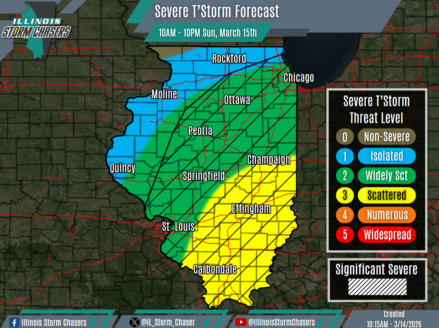
•With this update, we have expanded level 2 severe t’storm probabilities and have upgraded portions of the state to level 3 severe t’storm probabilities. These changes were made based on increasing confidence that higher coverage severe t’storm potential will exist. We have also added widespread hatching across the state, as some significant severe t’storms may occur.
⏰Timing…
•Sunday Morning – Sunday Night, March 15th.
📍Location…
•Much of Illinois.
⚡️Hazards…
•A level 1 to 3 severe t’storm threat is in place across much of the state from Sunday morning through Sunday night, for the threat of isolated to scattered severe t’storms. Damaging winds and a few tornadoes will be the main threats. Some significant severe t’storms will be possible, capable of producing widespread damaging winds and/or damaging winds of 75MPH+.
✔️Summary…
•As a storm system moves through the region, a cold front will sweep across the state between Sunday morning and Sunday night. Accompanying this front will be a forced squall line/QLCS, which will also traverse the state. Severe t’storms will be possible with this activity, some significant, with damaging winds and a few tornadoes being the main threats.
