
(11:45AM – Friday, January 23rd, 2026) Major winter storm to bring significant snowfall to the state this weekend…
❗Update…
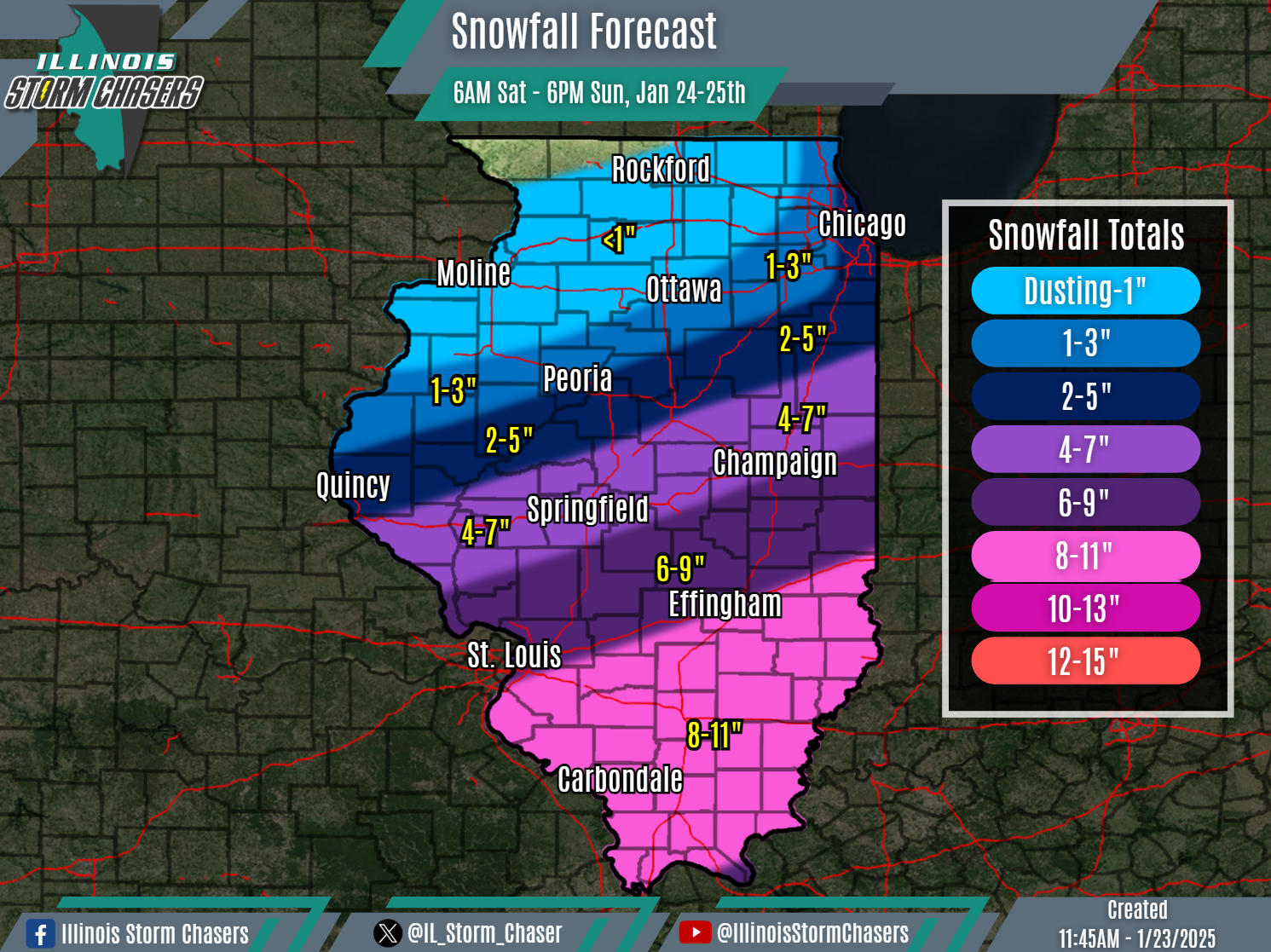
•With this update, we have increased expected snowfall totals across the southern half of the state, with confidence growing in accumulations as we approach the event.
⏰Timing…
•Saturday Morning – Sunday Evening, January 24-25th.
📍Location…
•Much of Illinois.
❄️Hazards…
•Widespread snowfall accumulation will be likely across the state. Highest snowfall amounts across roughly the southern half of the state, and lowest amounts across the northern half of the state. Highest snowfall totals on the order of 4-7″ to 8-11″ will be likely in the vicinity of I-72 and on southward to the southern tip of Illinois.
•Periods of moderate to heavy snow and snowfall rates of 1″+/Hour will be possible at times.
•Modest winds may result in some blowing and drifting snow, especially in open/rural areas.
•Travel will be impacted across much of the state, significantly so in some areas.
✔️Summary…
•A winter storm will move through the region over the weekend, bringing a widespread accumulating snowfall to a large portion of the state between Saturday morning and Sunday evening. Significant snowfall accumulation will be possible across portions of the state. •It should be noted that there may be a break/lull in snowfall during the later Saturday afternoon through early Saturday night timeframe for some areas.
