
(9:00PM – Saturday, December 6th, 2025) Several inches of accumulating snow and some mixed precip expected tonight into early Sunday…
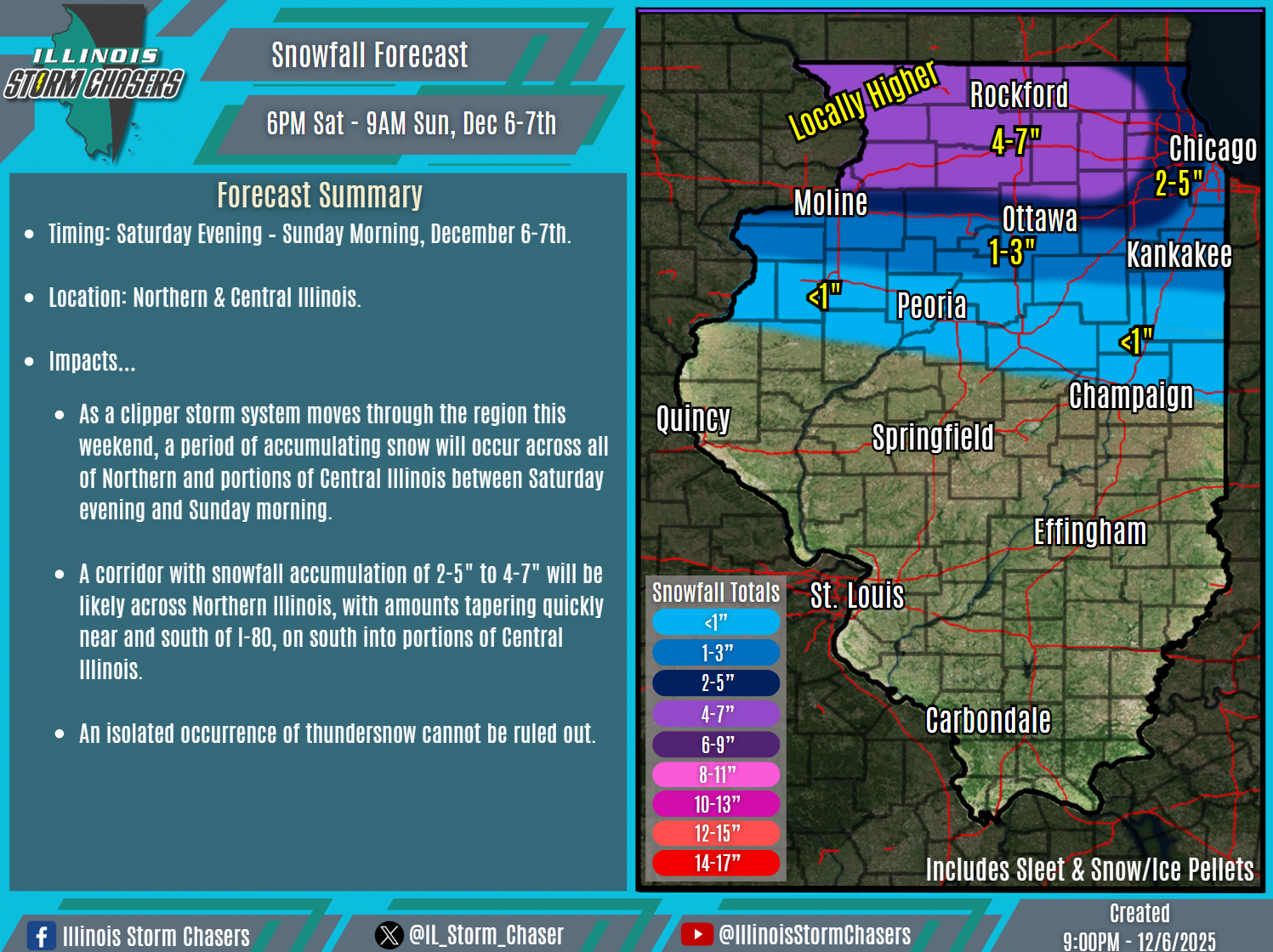
⏰Timing…
•Saturday Evening – Sunday Morning, December 6-7th.
📍Location…
•Northern & Central Illinois.
❄️🧊Hazards…
•A corridor with snowfall accumulation of 2-5″ to 4-7″ will be likely across Northern Illinois, with amounts tapering quickly near and south of I-80, on south into portions of Central Illinois. Snowfall rates in excess of 1″/hour will be possible at times, with periods of moderate to heavy snow. An isolated occurrence of thundersnow cannot be ruled out.
•A glaze of freezing rain/ice accumulation will be possible in a corridor south of I-80, across portions of Central Illinois.
✔️Summary…
•As a clipper storm system moves through the region this weekend, a period of accumulating snow will occur across all of Northern and portions of Central Illinois between this evening and Sunday morning. Additionally, mixed wintry precipitation will also be likely across portions of Central Illinois during the same timeframe.

