
(12:45AM – Saturday, November 29th, 2025) Major winter storm bringing significant impacts to the state through Sunday morning.
⏰Timing…
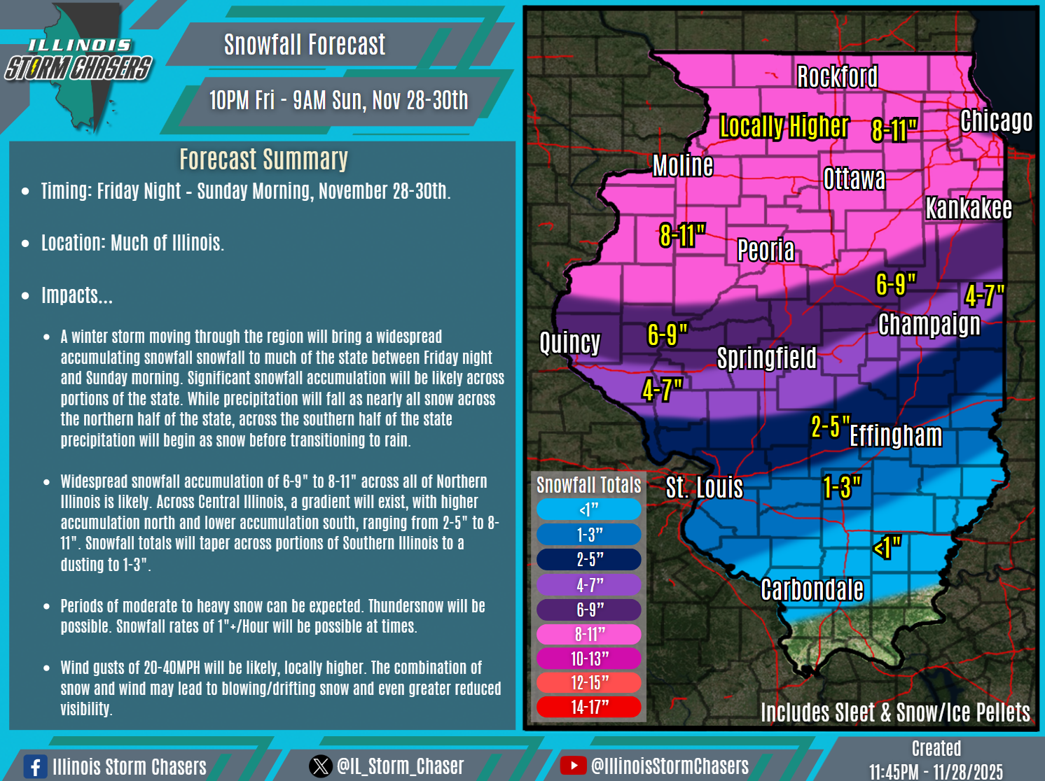
•Friday Night – Sunday Morning, November 28-30th.
📍Location…
•Much of Illinois.
❄️Hazards…
•Widespread snowfall accumulation of 6-9″ to 8-11″ across all of Northern Illinois is likely, with locally higher amounts possible. Across Central Illinois, a gradient will exist, with higher accumulation north and lower accumulation south, ranging from 2-5″ to 8-11″. Snowfall totals will taper across portions of Southern Illinois to a dusting to 1-3″.
•Periods of moderate to heavy snow can be expected. Thundersnow will be possible. Snowfall rates of 1″+/Hour will be possible at times.
•Wind gusts of 20-40MPH will be likely, locally higher. The combination of snow and wind may lead to blowing/drifting snow and even greater reduced visibility.
✔️Summary…
•A winter storm moving through the region will bring a widespread accumulating snowfall snowfall to much of the state between Friday night and Sunday morning. Significant snowfall accumulation will be likely across portions of the state. While precipitation will fall as nearly all snow across the northern half of the state, across the southern half of the state precipitation will begin as snow before transitioning to rain.
