
(11:30PM – Thursday, April 2nd, 2026) Yet ANOTHER storm system will bring a final round of severe t’storm potential to the state from Friday into early Saturday…
⏰📍Timing & Location…
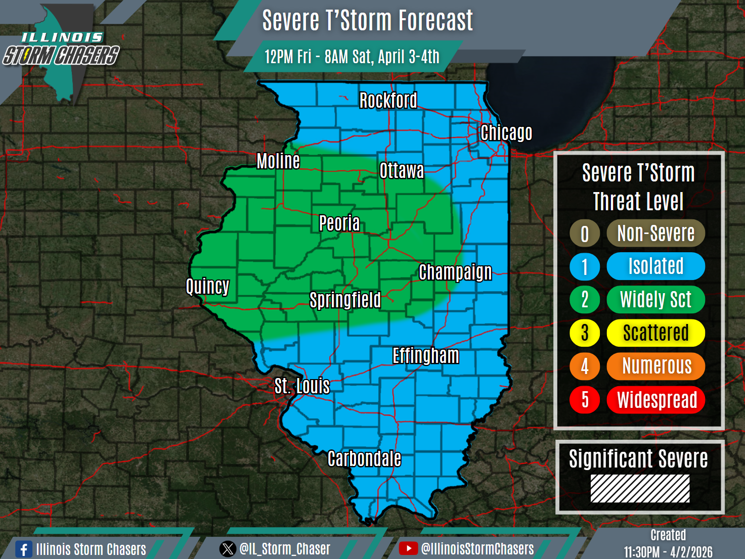
•Friday Midday – Saturday Morning, April 3-4th: All of Illinois.
⚡️Hazards…
•A level 1 to 2 severe t’storm threat is in place across all of Illinois from Friday midday through Saturday morning, for the threat of isolated to widely scattered severe t’storms. All modes of severe weather will be possible, including damaging winds, hail and a few tornadoes.
✔️Summary…
•Friday Midday – Saturday Morning… A few lingering isolated showers and t’storms may be ongoing on Friday morning across portions of Central and Southern Illinois, in the vicinity of what will be a stationary frontal boundary. As this frontal boundary lifts northward as a warm front on Friday afternoon and evening, isolated to scattered showers and t’storms will develop in the vicinity of the lifting boundary across Central Illinois. This activity will pose an isolated to widely scattered severe t’storm threat, as it lifts north from Central and into Northern Illinois from Friday afternoon into early Friday night. Also of focus will be a loose QLCS, which will develop across Iowa and Missouri on Friday. This activity, in a gradually weakening phase, will traverse much of the state from later Friday evening through Saturday morning. This activity may pose a severe t’storm threat as well.
